Best Oregon Coast Hikes Near Gearhart
Eight hiking trails sit within 45 minutes of Gearhart, ranging from a flat loop you can walk before breakfast to a 1,634-foot summit climb with wildflower meadows. This guide covers each one with drive times from Gearhart, current parking fees, trail closures, difficulty, and dog policies — the practical details most online trail listings leave out.
In short:
- Closest trail: Gearhart Ridge Path — a 4.1-mile loop through a Sitka spruce tunnel, starting two blocks from downtown. No fee, no drive.
- Best coastal views: Tillamook Head Trail (6 miles, moderate-challenging) and Cape Falcon Trail (4.8 miles, moderate) both end at cliff-edge panoramas.
- Fees to know: Ecola State Park charges $10 day-use (as of January 2025 — doubled from $5). Fort Clatsop charges $10 per adult, no cash accepted. An Oregon annual pass covers all state parks for $60.
- Current closure: Clatsop Loop Trail's west section has been closed since April 17, 2026 due to an active landslide. The east section and all other trails on this list remain open.
- Dog-friendly options: Most trails allow leashed dogs. Rules vary by park — details under each trail below.
Quick-Reference: Trails by Difficulty
| Trail & Distance | Elevation Gain | Difficulty |
|---|---|---|
| Gearhart Ridge Path (4.1 mi loop) | 75 ft | Easy |
| Fort Stevens State Park (1–6 miles and varies depending on what route you take) | Minimal | Easy |
| Youngs River Falls (0.5 mi) | Minimal | Easy |
| Fort to Sea Trail (6.5 mi one-way) | 505 ft | Easy–Moderate |
| Cape Falcon Trail (4.8 mi out-and-back) | ~500 ft | Moderate |
| Ecola State Park - Clatsop Loop (3.0 mi loop) | ~785 ft | Moderate |
| Tillamook Head Trail (~6 mi one-way) | ~1,350 ft | Moderate–Challenging |
| Saddle Mountain (5.2 mi round trip) | 1,634 ft | Difficult |
Here is a map you can use as a visual aid to find out more about the best hikes near Gearhart on the Oregon Coast
What Are the Easiest Hikes Near Gearhart?
Three trails near Gearhart are flat enough for strollers and sandals — Gearhart Ridge Path starts in town, Fort Stevens State Park is a 15-minute drive north, and the opening stretch of the Fort to Sea Trail covers easy ground through old-growth forest.
Gearhart Ridge Path
The Ridge Path is the trail we send guests to when they want a walk they can start before breakfast. It begins two blocks from downtown Gearhart and loops 4.1 miles through what the Oregon Hikers field guide calls a "green tunnel" of Sitka spruce, hemlock, and salal. Elevation gain is 75 feet — essentially flat.
The path threads past cottages and numbered streets before reaching footbridges over marsh areas, sandy beach, and the Necanicum Estuary. Birdwatchers spot pelicans, Caspian terns, and bald eagles along the estuary section — the same species covered in the resort's birding guide for the Oregon Coast. The full loop includes about 0.6 miles on residential streets to close the circuit.
Drive time from Gearhart: None — the trailhead is in town.
Fee: Free.
Dogs: Allowed. On Necanicum Spit (March 15 – September 15), dogs must be leashed in the Western Snowy Plover Management Area.
Fort Stevens State Park
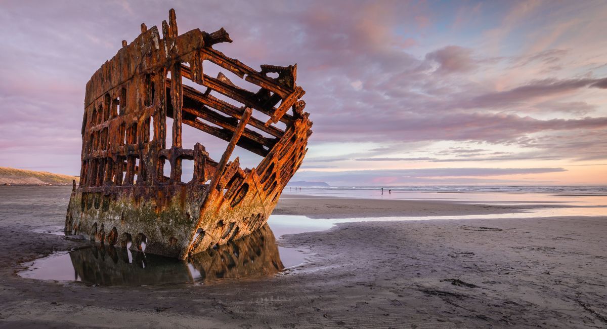
Fifteen minutes north of Gearhart, Fort Stevens spreads across 4,300 acres of dunes, forest, and coastline — one of several outdoor activities near Gearhart that don't require serious hiking gear. The park has several short trails — the most popular leads to the wreck of the Peter Iredale, a 1906 barque whose rusted skeleton sits on the beach. A network of paved and gravel paths connects to Battery Russell and other military fortifications from the Civil War through World War II.
Drive time from Gearhart: 15 minutes.
Fee: $10 day-use parking permit ($12 for non-residents). An Oregon annual state parks pass ($60) covers day-use at Fort Stevens and all other fee-charging state parks.
Dogs: Leashed on trails; off-leash on the beach outside Plover nesting season.
Youngs River Falls
A short drive south of Astoria, Youngs River Falls is a 54-foot cascade reachable via a 0.5-mile walk from the parking area. It works as a quick side trip rather than a dedicated hiking outing — but the falls are worth the 30-minute drive from Gearhart, especially after winter rain pushes the volume up.
Drive time from Gearhart: 30 minutes.
Fee: Free.
Dogs: Leashed.
Which Trails Have the Best Coastal Views?
Tillamook Head Trail and Cape Falcon Trail both end at exposed headlands with wide-angle views of the Pacific. Tillamook Head is longer and harder; Cape Falcon is a half-day commitment with similar payoff.
Tillamook Head Trail
This is the signature north coast hike. The trail runs roughly 6 miles one-way between Seaside and Ecola State Park, following the route Lewis and Clark took in January 1806 to reach a beached whale near present-day Cannon Beach. Clark wrote that the view from the headland was "the grandest and most pleasing prospects which my eyes ever surveyed."
The mud on Tillamook Head catches people off guard, even in July. We tell hikers to plan for it — waterproof boots are not optional here. The trail climbs through old-growth Sitka spruce, crosses several creek drainages, and reaches viewpoints where you can see Tillamook Rock Lighthouse perched on its offshore basalt rock.
Starting point matters. From the Seaside trailhead, you climb steeply for the first mile and then level off. From the Ecola end, the grade is gentler but requires the $10 state park day-use fee. Most day hikers start from Seaside, hike to a viewpoint, and turn around — the full traverse requires a car shuttle.
Drive time from Gearhart: 10 minutes to the Seaside trailhead; 20 minutes to Ecola State Park.
Fee: Free from Seaside. $10 day-use from Ecola end.
Dogs: Leashed (6-foot max) on all Ecola trails. No restrictions on the Seaside side outside nesting season.
Time: 3–5 hours for a round-trip day hike from Seaside. Full traverse is 5–7 hours one-way.
Cape Falcon Trail
Cape Falcon is 4.8 miles out and back, starting from the Oswald West State Park trailhead on Highway 101 between Cannon Beach and Manzanita. The trail climbs through fern-lined forest with Sitka spruce and western red cedar, crosses boardwalks over muddy drainages, and ends at an exposed headland overlooking Smuggler Cove and Neahkahnie Mountain.
In our experience, the Cape Falcon parking lot fills by 10 a.m. on summer weekends. An overflow lot with restrooms sits about a quarter mile south on the east side of the highway. The final approach to the cape has exposed tree roots and narrow sections with wire railings — watch your footing.
Drive time from Gearhart: 35 minutes.
Fee: $10 day-use parking permit (Oswald West State Park).
Dogs: Allowed on leash.
Time: 2–3 hours round trip.
Is Ecola State Park Worth the $10 Fee?
The $10 day-use fee at Ecola State Park (as of January 2025) covers access to Indian Beach, Ecola Point viewpoints, the east section of Clatsop Loop, and the southern trailhead for Tillamook Head Trail. We've watched the fee confusion trip people up — the park doubled its rate from $5, and plenty of online guides still list the old price. An Oregon annual pass ($60) pays for itself after six visits to fee-charging state parks.
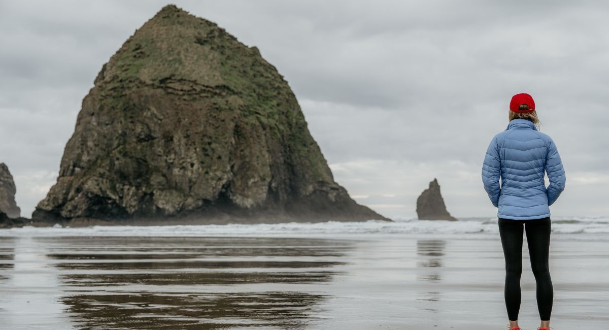
What's open: Indian Beach is a sheltered cove popular with surfers and tide-pool explorers. The 1.3-mile trail from the parking area to Indian Beach descends through forest and opens to a rocky beach flanked by headlands. Ecola Point, accessible from the main parking lot, offers views south to Haystack Rock and north toward Tillamook Head.
Clatsop Loop Trail — Partial Closure
The Clatsop Loop Trail is a 3.0-mile loop through old-growth forest with ocean glimpses. As of April 17, 2026, the west section is closed due to an active landslide — Oregon State Parks lists the closure as "until further notice." The east section remains open as an out-and-back.
No other SERP result for "hikes near gearhart" or "ecola state park hikes" mentions this closure. If you're planning a visit specifically for Clatsop Loop, check the park's website for the latest status before driving out.
Drive time from Gearhart: 20 minutes.
Fee: $10 day-use, purchased on-site. No overnight parking allowed. Large vehicles and motorhomes are discouraged — the access road is narrow with tight turns.
Dogs: Leashed (6-foot maximum) on all trails. Off-leash at ocean shore if under voice control and handler carries a leash.
How Hard Is the Saddle Mountain Hike?
Saddle Mountain is the hardest hike on this list — 5.2 miles round trip with 1,634 feet of elevation gain to a 3,288-foot summit, the highest peak in Clatsop County. The final half-mile involves exposed scramble sections with cable handrails. This is not a casual outing.
The reward is a 360-degree panorama: the Pacific coastline from Seaside to Tillamook, the Columbia River, and on clear days, Mount Rainier and Mount St. Helens. The trail starts in dense forest, breaks into open meadows around the saddle, and becomes progressively steeper and more exposed.
Wildflower timing: Late May through June is peak wildflower season on Saddle Mountain. The subalpine meadows near the summit host species found nowhere else on the coast — the mountain's isolation created a botanical microenvironment. This window is the reason most experienced hikers time their trip for early June.
Drive time from Gearhart: 45 minutes (take US-26 east to Saddle Mountain Road).
Fee: Free (state natural area — no day-use fee).
Dogs: Leashed. The trail is steep and exposed near the summit; not all dogs will be comfortable.
Time: 3–5 hours round trip.
Can You Hike the Fort to Sea Trail in a Day?
The Fort to Sea Trail covers 6.5 miles one-way from Fort Clatsop — where Lewis and Clark spent the winter of 1805–06 — to Sunset Beach on the Pacific. The trail passes through Sitka spruce forest, coastal wetlands with skunk cabbage blooms (peak in February), working farmland, and dune crossings before reaching the beach.
The National Park Service maintains the trail year-round. Starting from the Fort Clatsop end gives you the historical context — the restored fort and visitor center are worth 30 minutes before you set out. A partial loop is possible via the Kwis Kwis Trail if you don't want to cover the full one-way distance.
Most day hikers we talk to start from Fort Clatsop, walk 2–3 miles through the forest section, and turn around. The beach end at Sunset Beach is free to access, so if you arrange a shuttle or have two cars, the full one-way hike works well at a moderate pace.
Drive time from Gearhart: 25 minutes to Fort Clatsop.
Fee: $10 per adult at Fort Clatsop (as of July 2026), valid for 7 days. No cash accepted — card or NPS pass only. Sunset Beach end is free.
Dogs: Leashed on trails within the national historical park.
Time: 2–3 hours for a partial out-and-back. 4–5 hours for the full one-way traverse.
Are Dogs Allowed on Oregon Coast Trails?
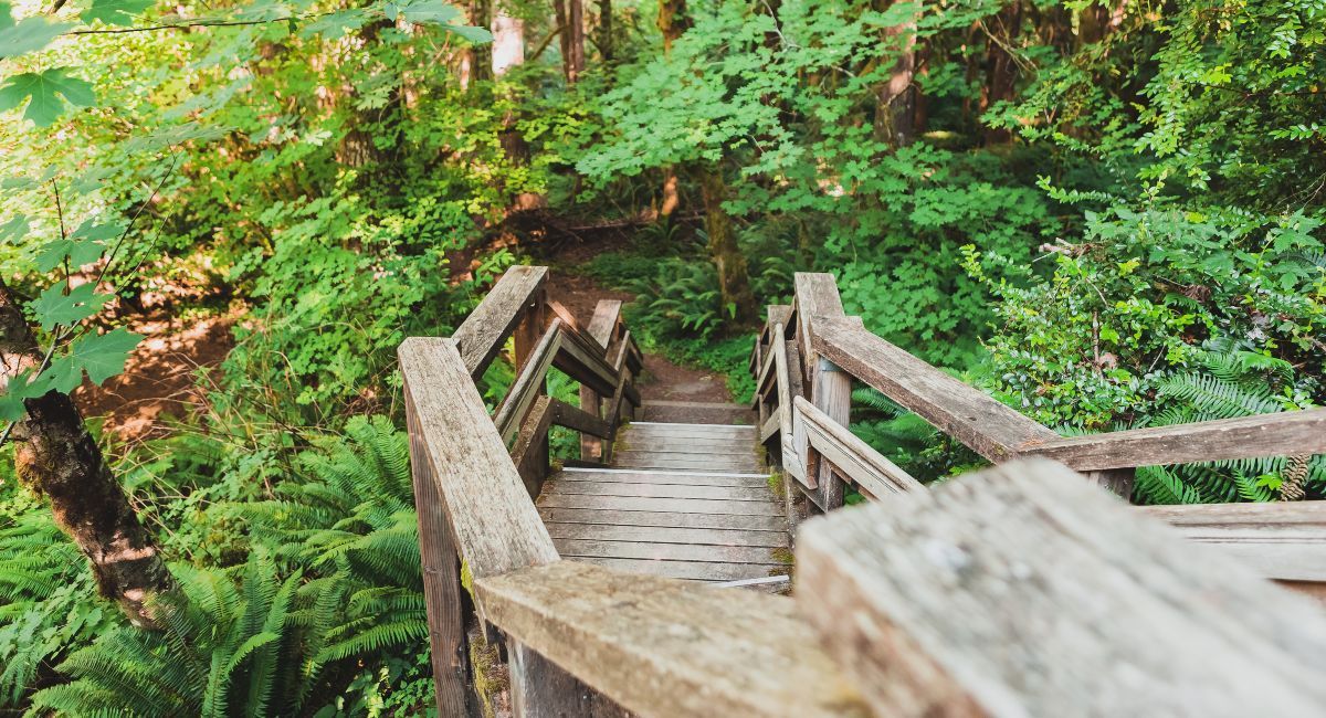
Rules vary by park and season. Here is a breakdown for every trail in this guide where dogs are allowed:
| Trail & Distance | Leash Required? | Notes |
|---|---|---|
| Gearhart Ridge Path (4.1 mi loop) | Seasonal | Leash required Mar 15 – Sep 15 on Necanicum Spit (Snowy Plover area) |
| Fort Stevens State Park (1–6 miles and varies depending on what route you take) | On trails | Off-leash on beach outside nesting season |
| Youngs River Falls (0.5 mi) | Yes | Standard leash |
| Fort to Sea Trail (6.5 mi one-way) | Yes | NPS-managed — leash required |
| Cape Falcon Trail (4.8 mi out-and-back) | Yes | Standard leash |
| Ecola State Park - Clatsop Loop (3.0 mi loop) | Yes (6 ft max) | Off-leash at ocean shore if under voice control + handler carries leash. Not during nesting season. |
| Tillamook Head Trail (~6 mi one-way) | Varies | Leash required on Ecola side; no restriction on Seaside side outside nesting season |
| Saddle Mountain (5.2 mi round trip) | Yes | Steep/exposed near summit — assess your dog's comfort |
The recurring theme:
Western Snowy Plover nesting season (March 15 – September 15) restricts off-leash beach access across most of the north coast. If you're visiting in summer with a dog, plan for leash-on at beaches and estuaries.
What Should You Wear for North Coast Hiking?
A waterproof rain jacket is non-negotiable on the north Oregon coast. Summer temperatures hover in the mid-60s with fog and drizzle common even in July and August — the FitForTrips Oregon Coast hiking guide puts it plainly: "A really good quality, lightweight rain jacket and pants are absolutely essential."
Footwear: Waterproof hiking boots or trail runners. We've seen enough guests come back from Tillamook Head in running shoes to say this plainly: the forest trails on Tillamook Head, Cape Falcon, and Fort to Sea are muddy year-round. Gearhart Ridge Path and Fort Stevens work fine in sturdy sneakers. Saddle Mountain needs ankle support — the descent punishes knees.
Trekking poles: Recommended for Tillamook Head and Saddle Mountain. Both trails have steep, slippery sections where poles prevent falls and reduce joint strain.
Layers: Even a sunny morning can turn overcast in an hour. A moisture-wicking base layer under a rain shell handles most conditions. Leave the cotton at your condo.
For more
things to do on the Oregon Coast, check
current deals and specials, or
browse beachfront condos in Gearhart.
About This Guide
This guide was researched and written by the Gearhart by the Sea editorial team. Trail distances, elevation data, and fees were verified against Oregon State Parks, the National Park Service, and the Oregon Hikers field guide. Drive times were calculated from downtown Gearhart. We have no commercial relationship with any state or federal park agency. Fee amounts are current as of publication; check the linked agency pages for the latest rates before your visit.
Frequently Asked Questions
Do you need a reservation for Ecola State Park?
No reservation is required for day-use visits to Ecola State Park. You purchase a $10 parking permit on-site when you arrive. The park does not accept overnight parking anywhere within its boundaries, so plan for a day trip only. An Oregon annual pass ($60) covers day-use at all Oregon state parks that charge a fee and pays for itself after six visits.
Is the Tillamook Head Trail hard?
Tillamook Head is a moderate-to-challenging hike — 6 miles one-way with roughly 1,350 feet of cumulative elevation change. The trail is muddy year-round, including summer. Starting from Seaside involves a steep initial climb; the Ecola end is gentler but requires the $10 park fee. Plan 3–5 hours for a round-trip day hike from either trailhead.
How long is the Fort to Sea Trail?
Describe the item or answer the question so that site visitors who are interested get more information. You can emphasize this text with bullets, italics or bold, and add links.Are dogs allowed at Ecola State Park?
Dogs are allowed at Ecola State Park but must be leashed on all trails — the leash cannot exceed six feet. At the ocean shore, handlers may allow off-leash movement if the dog stays within sight and responds to voice commands. Handlers must carry a leash at all times. These rules do not apply during Western Snowy Plover nesting season (March 15 – September 15), when leash requirements extend to beach areas.
When is the best time to hike Saddle Mountain?
Late May through June is the peak window for Saddle Mountain. The subalpine wildflower meadows near the summit bloom during this period, and the trail is typically snow-free. Summer and early fall are also good — the trail is usually clear May through October. Avoid winter months, when steep sections near the summit ice over and become dangerous.
Is the Clatsop Loop Trail open?
Partially. The west section of the Clatsop Loop Trail in Ecola State Park has been closed since April 17, 2026 due to an active landslide. Oregon State Parks lists the closure as "until further notice." The east section remains open for hiking as an out-and-back. Check the Ecola State Park page on Oregon State Parks' website for the latest status before your visit.
Do I need an Oregon State Parks pass?
Describe the item or answer the question so that site visitors who are interested get more information. You can emphasize this text with bullets, italics or bold, and add links.
Recent Posts